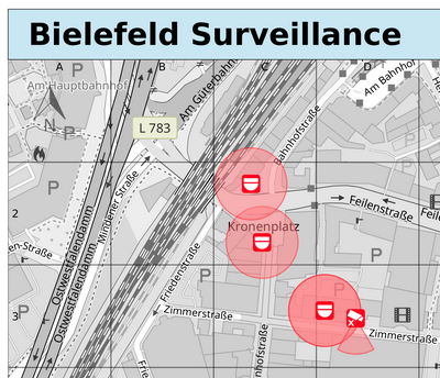
I’ve finally shown the surveillance overlay some love again, the render style should now be up to date with the original Surveillance under Surveillance online map style.
Changes include:
- correctly calculate camera viewing ranges independent of zoom level
- support for new camera symbols for fixed and panning cameras
- some code cleanups
To create a printable surveillance map for your area:
- Go to my MapOSMatic instance
- Select area by city name, or by choosing a rectangular geographic area
- Choose a page layout (the default should be OK)
- Choose a map style (#3 “Monochrome version of CartoCSS OSM” is probably best for this)
- Choose the “Surveillance Camera” overlay from the overlay list (3rd from the bottom)
- Choose a paper size and orientation
- You can skip the GPX track upload step
- Enter a page title, and optionally a notification email address
- Submit request
Single page render requests should usually only take 5 minutes or less to process, but depending on queue size and complexity of other jobs in the queue longer wait times are sometimes possible.