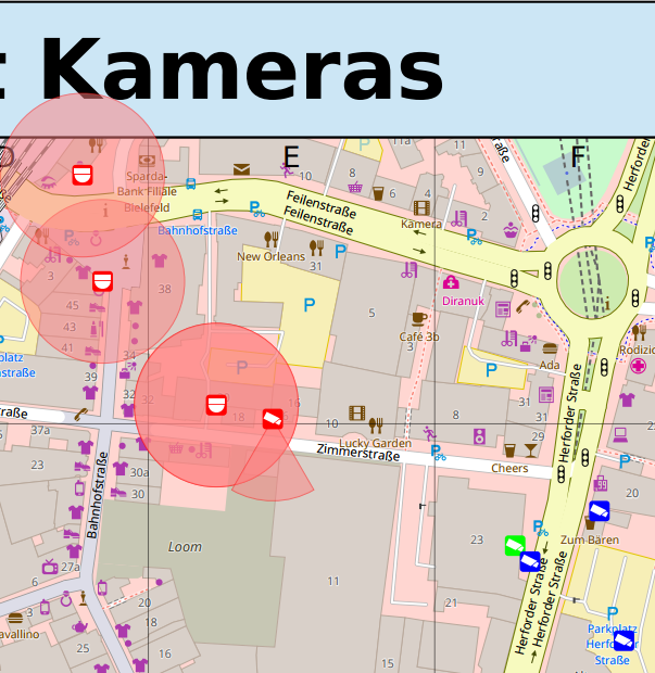
I’ve added another overlay style that tries to display the same information as the Surveillance under Surveillance map, showing surveillance cameras and an estimate of the areads covered by them.
Unfortunately it wasn’t possible to easily archive this with a Mapnik stylesheet as neither Mapnik nor PostGIS come with an easy way to generate circle segments.
I first tried to use the experimental Python input plugin for Mapnik to implement this, but couldn’t get this running with Mapnik v3.
I also thought about using pl/Python on the database side to generate circle segments, but eventually decided to implement this in the Ocitysmap render itself, completely bypassing Mapnik.
For this I created a simple plugin interface for adding render plugings that can directly draw into the maps Cairo context, on top of the output already generated by Mapnik.
More on Ocitysmap render plugins will be published in a separate blog post.
One thought on ““Surveillance under Surveillance” Overlay”